Impossible Distancing on Charleston Sidewalks
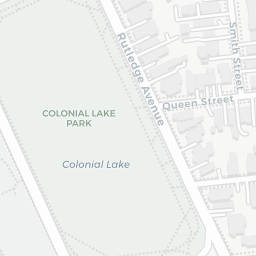
One of the few places to maintain a safe distance from other pedestrians, Colonial Lake is closed during the Shelter-in-Place.
Since March 26, the City of Charleston has been under a “Shelter-in-Place” ordinance with residents encouraged to stay home except for essential trips (grocery store, doctor’s appointments, etc) and outdoor exercise.
There has been a noticable increase in pedestrian traffic as residents take neighborhood walks, particularly given the recent good weather. However, C.D.C. social distancing guidelines recommend maintaining at least a six foot distance from others (especially from those not in the same family/living under the same roof). In order to safely allow two pedestrians to pass each other, a sidewalk would reasonably need to be at least eight feet wide, at a minimum. In most of Charleston’s neighborhoods, the average sidewalk is less than 6 feet wide.
Given the narrow nature of Charleston sidewalks, the Mayor and City Council should consider closing some neighborhood streets to vehicular traffic to allow pedestrians to safely practice social distancing and prevent further spread of Covid-19.
City of Charleston Data #
All data used for this analysis is from the City’s Open Data Initiative. I used the Edge of Pavement shapefiles, which track the pavement, sidewalks, driveways, etc, and the Neighborhood Council shapefiles to focus on the more residential areas of the city. Each record of Edge of Pavement data is a separate section of pavement throughout the city, whether it’s a sidewalk, driveway, unpaved parking lot, etc.
Data Cleaning and Calculating Sidewalk Width #
I have some concerns about the Edge of Pavement dataset, as it is comprised of several older data sources. The City also acknowledges that there could be inaccuracies in the Terms of Use. When I calculated the width of the sidewalk in front of my house using the Edge of Pavement data, I got 2.5 ft, but when I measured the width with a tape measure, it was 5 ft across. I recorded similar numbers in front of my parents’ house. During a quarantine walk, I spot-checked several other sections of sidewalk in my neighborhood and found the City data fairly inaccurate. So, I created a sidewalk width using the shape files and then, unscientifically, doubled it for every sidewalk width observation, bringing the City’s data more in line with my field analysis. All figures represented in maps reflect this doubling. I am quite aware that this data is full of inaccuracies, but I am trying to use this data as a representation, not as an exact model
I am not familiar enough with all city neighborhoods to know how accurate the data is for all neighborhoods. I did note, for example, that South Windemere does not have sidewalks in the traditional sense. Driveways seem to be marked as the only sidewalks in the neighborhood, not even offering pedestrians a continuous safe place to walk from vehicular traffic.
Average Sidewalk Width per Neighborhood Council #
Per Neighborhood Council, I calculatd the average width of sidewalk. As noted above,the sidewalk width has been doubled from the shapefile to attempt to correct for inaccurate data.
*Even given the doubling in sidewalk width (discussed above), most neighborhoods’ average sidewalk width is less than 6 feet.
Individual Sidewalks per Neighborhood #
If you look closely at each neighborhood, you can see the sidewalk bits, colored by their width.
For the forseeable future, a reasonable solution to keep Charlestonians safe is to close some neighborhood streets to vehicular traffic (local traffic only, perhaps) to allow pedestrians to walk a safe distance from one another.
A few suggestions from the Peninsula, based on where many people exercise:
- East Bay Street from Broad Street to the Battery and the continuation of Murray Boulvard from the Battery to the Coast Guard Station.
- Mary Murray Drive
Code used to generate maps here.
